Day 58 (745 – 755)
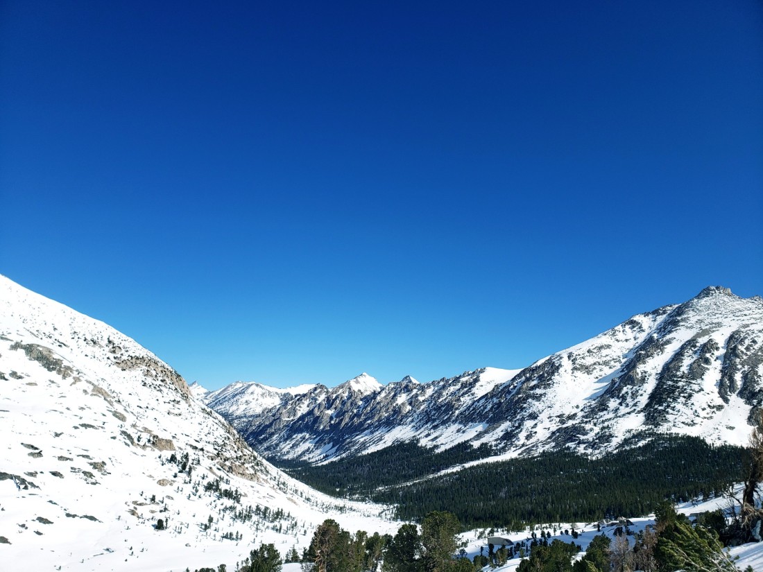
Today Salsa and I left Lone Pine to continue our journey into the Sierras. Up to this point conditions weren’t too bad but we knew some of the hardest sections were just ahead of us. In a few days we’d be crossing Forester Pass, the highest location on the PCT at 13,200 feet. Sunny and Ent decided to wait a day in Lone Pine to decide if they wanted to continue the Sierras or flip ahead. If they continued, we’d meet them in a little while since they would not do the optional Mount Whitney climb and we would.Already the snow had melted quite a bit since we descended into Lone Pine. Previously this meadow was 100% snow covered and now just a few days later it was much more patchy. The snow was still abundant and we pretty much had snow travel for the entire day. It was exhausting and it showed us just a little of what the Sierras had in store.
 The snow was definitely beautiful and it gave everything a winter wonderland type of vibe. But our progress was slow and steep climbs in slushy snow ensured that we didn’t reach our campsite till much later than we’d have liked.
 Thankfully we found a few snow free patches of ground to camp on in the valley below. Today was one of the most exhausting days and it felt like we had finally entered the mountains proper.
 Day 59 (755 – 767)To be honest I don’t remember much of what happened today and my notes just say “woke up with frozen socks”. So here’s some of the pictures I took to tell the story instead.


 Day 60 (14 miles off trail)Unlike yesterday today would go down as one of the top 5 most memorable days of my life. Today we would climb Mount Whitney, the tallest mountain in the lower 48 states at 14,505 feet.
Yesterday we got to our campsite very early and passed out around 6:00 PM in order to get an early start up the mountain. We had to start climbing at around 1:00 AM to ensure that we would make it to the summit before the snow became slushy and dangerous. Frozen, icy snow is actually the safest snow to hike on when doing steep traverses because your traction devices (microspikes/crampons) are able to actually dig in and provide a good amount of grip. In slushy snow you pretty much just slip and slide all over the place.
Unfortunately, because we started hiking at 1:00 AM I don’t really have any good pictures for most of the climb. It was basically pitch black until we were within about a mile of the summit. So I’ll try my best to describe one of the most epic “hikes” I’ve ever done.I put hikes in quotes because much of the climb was straight up mountaineering, not hiking. To start things off we had to cross a very swift moving creek immediately upon waking up at 1 AM. The log bridge was completely frozen over since the air temperature was around 30 degrees. Thankfully we made it across without slipping and falling in.Next we followed the creek to the base of the mountain since the trail was basically completely buried in snow.
Once we got to the base of the mountain we took some time to catch our breaths and prepare ourselves for what was ahead. 4000 feet of elevation gain over 7 miles. We had no clue what was actually ahead, however. We were just following the trail of headlamps of other people climbing the mountain. It actually looked really awesome but we were just hoping the people in front were picking the right path.Things were going alright until we got to the “Wall”. The “Wall” as I like to refer to it is an incredibly steep ice/snow wall that climbs straight up the mountain. In normal, low snow years, there are gentle switchbacks which take you slowly up the mountain. In fact it’s a fairly easy climb in good years. This year, because of the record snow, the switchbacks were completely buried in snow and so we had to go straight up this ice wall to get to the top. It’s hard to approximate the steepness or convey it in words but without question a slip would have sent you sliding thousands of feet to the bottom of the mountain. There was zero room for error here.
At points I was on all fours going up this wall because some of the parts were so steep and treacherous. And I couldn’t turn back since there was a line of people coming up behind me although I could only see their headlamps in the abyss below.
The Wall climbed about 1000 feet in elevation and it took us over an hour due to the exhaustion of going up a 45 degree slope. Not to mention we were all feeling scared since every step needed to be perfectly placed. Thankfully there were tracks going up that we could follow but they weren’t always enough to get good traction in the ice so we had to kick our own steps occasionally.
Eventually the Wall leveled out and we arrived at the much more gradual final trail to the summit. And by this point it was starting to get light so I have some pictures.
 The trail was still sketchy in parts due to sheer drop offs on one side but at least there was an actual trail in the snow and it was level. The sunrise and views over the rest of the Sierras were unlike anything I had ever seen before. Just absolutely overwhelming beauty.
 Light enough now for a selfie on the final push to the summit. This part wasn’t even that steep compared to the Wall but it gives you an idea of the conditions somewhat.
 Around 6:00 AM, after 5 hours of climbing, we made it to the summit of the highest mountain in the lower 48. 14,505 feet. There was a little shelter at the top but it was completely filled with snow.
 Obligatory summit picture with my ice axe that I actually used heavily for most of the climb.
 I had a celebratory drink with Salsa at the top. We just took a sip since the altitude was already making us feel pretty bad. Although some people were feeling the altitude much worse. Some had to turn around because of the headaches and nausea and general grogginess.After 15 minutes of celebrating we started heading back down to hit the snow before it started getting soft and dangerous.
 Here’s Salsa on the way back down to give you an idea of the trail conditions near the top.
 And here’s me on a typical descent. I’m using my ice axe on my uphill side to anchor each step.
 Here’s a picture of the steep ice wall on the way down. Only this time we stuck to the rocks more since it was a little bit more safe.
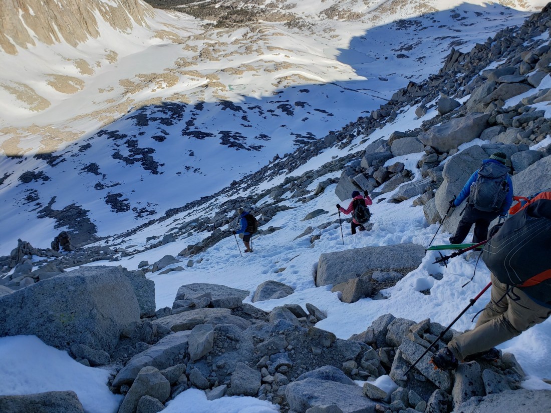 After struggling down the mountain for a few more hours we finally made it to flat ground. The descent was much easier since we could actually see where we were going.
 Some of my thoughts about Whitney:
1. Getting back to camp felt incredible and I just passed out on the ground outside my tent. It was one of the most physically and mentally taxing days of my life.
2. I probably shouldn’t have climbed Whitney in these conditions.
3. It was the most spectacular view from the top and I could barely take it all in.
4. I would never forget the experience. Partly because of how scary it was and partly because of how accomplished I felt afterwards.
Day 61 (767 – 775)
I’m not sure how today could even compare to climbing Whitney. But it was actually a really great day.We started by crossing the same frozen log bridge we had to cross to get to Whitney. Shortly after crossing this creek we encountered another one, only this time much more dangerous. A large group of hikers had bunched up at the crossing trying to figure out a way across.
 Salsa and I decided to go downstream a ways to look for a better crossing point. After a while we found a log with a snow bridge on top. We decided this was the safest crossing option and crossed.
 Just about an hour later we came over a hill and ran into Sunny, Ent, and Slingshot again! We weren’t sure if we’d see them again for the Sierras but they decided to go for it and now our group was complete again.
 Look at this awesome light show in the sky. Anyone know what it is?
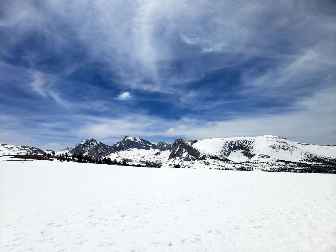
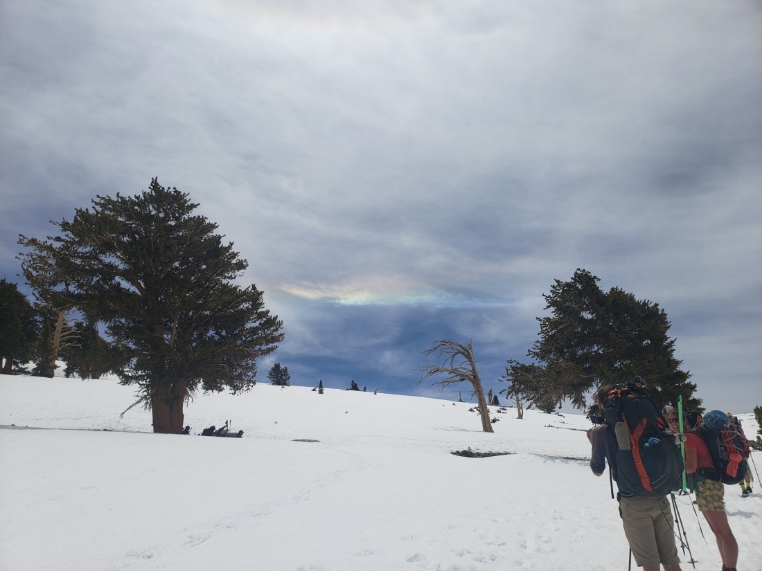 For a while were were just hiking in snow fields which was so serene and calming. The expansiveness of it all was just mind boggling.
 Gathering water from melting snow – my filter was broken so I just drank the snowmelt without filtering. About as clean as you can get from a natural source.
 When we camped there were only a few dry spots and tons of hikers. Everyone was camping here because it was the last spot before doing the huge climb over Forester Pass – the highest point on the PCT.
Look at this marmot taking a nap. Thankfully I nabbed a dry spot next to a snow bank.
 Unfortunately the hot afternoon sun began to rapidly melt the snow and my tent was in danger of being flooded so I dug a canal to reroute the water away. I was pretty proud of my handiwork.
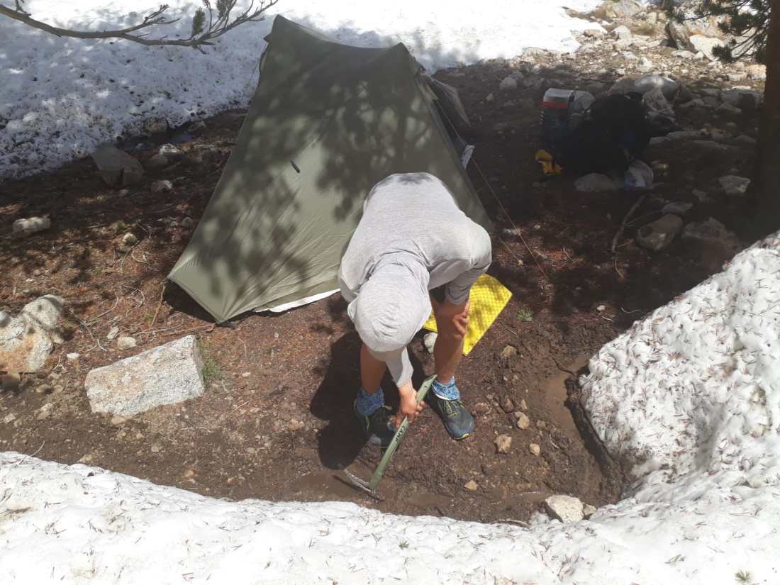 We’d have to get up at 2:00 AM to do Forester Pass tomorrow so we all went to bed early.
Day 62 (775 – 788)
We all got up at 2:00 AM and were hiking by 3. Today we’d ascend up and over Forester Pass, the highest location on the PCT. We knew conditions would be rough because of the snow so getting up early was critical. Approaching the base of Forester felt almost exactly like the approach to Whitney. Jut hiking by the light of our headlamps through snowfields. Just as it was becoming light we starting the climb up some gradual switchbacks in the snow. So far so good.
 After climbing up the gradual snowy switchbacks the really hard stuff began.The first challenge was getting past some rocks on the “trail”. There were two options:
1. Go up and over the rocks – which were frozen and no hand or footholds.
2. Go under/around the rocks.
This path had no steps but looked much safer regardless. Since I was in front I spent some kicking a couple steps in the snow so we could get around.
Person #2 in the picture below is taking this route.At this point there were close to 20 people behind up trying to get over the pass and this obstacle created a traffic jam as people decided how to tackle it. Thankfully our group eventually made it across after some time. After this first rock problem we went up some more switchbacks until we got to the final and infamous “snow chute” portion of the pass. You can see in the picture below just how many people were bunched up behind this chute. At points we had to get on all fours to get under the rock overhang. All the while we were making sure not to slip the thousands of feet down to the bottom of the pass.
 Here’s the notorious snow chute. It was basically just 50 steps kicked into this incredibly steep snow wall. A slip or misstep would mean almost certain death if you couldn’t stop or slow your slide. Thankfully the snow was solid and I was able to make it across safely by taking my time and anchoring in with my axe each step.
 After crossing the chute there were a few more sketchy switchbacks and rock scrambling before reaching the top. Whew, I made it safely to the top of the highest point on the PCT at 13,200 feet.
 Everyone celebrated to be alive and we all nervously joked a out how insane the past hour or two were. Unlike Whitney all the scary stuff was packed into a couple really intense sections.
The views into the valley below helped calm us down though.
 The descent down to the valley was just miles of hiking through slushy snow. But it was incredibly scenic.
 At some points we had the opportunity to slide down the snow on our butts. The technical mountaineering term is “glissading”.
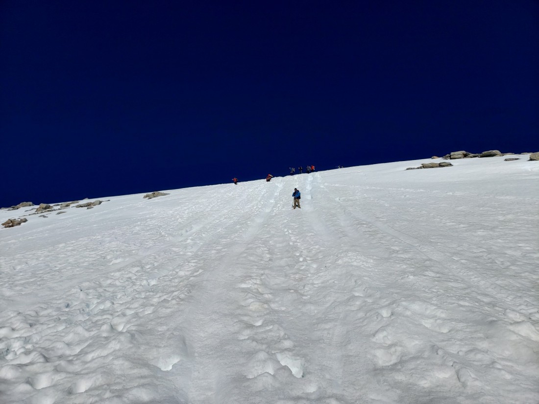 The sun reflected off the snow so you had to bundle up to keep from getting burned. Despite all the snow it was very hot hiking.
 In the valley there was evidence of a recent avalanche. Just look at how these trees got absolutely leveled. We were definitely humbled by the power of these mountains.
 Exhausted, we camped at the junction to the next Sierra exit point. Tomorrow we would just have to hike 9 miles on a side trail and hitchhike to the town of Bishop.
Day 63 (9 miles off trail)
This is the view from the top of Kearsarge pass, the side trail which would take us out of the mountain and back to civilization.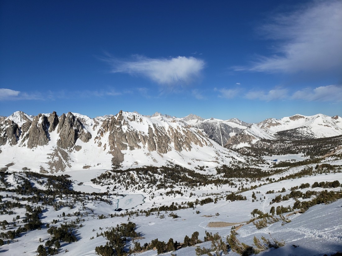
 Look at how this rock rolled down from the mountain across the trail. Good thing we weren’t close when it happened.
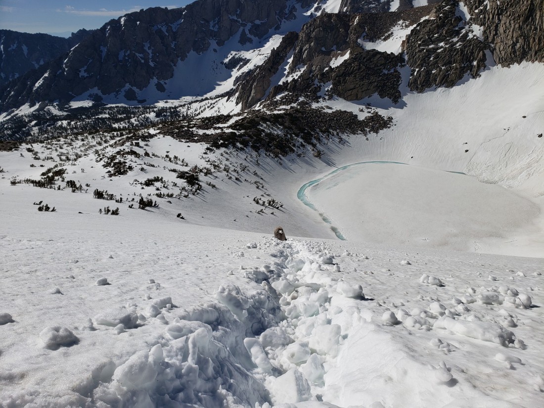 Down there was the desert and the town of Bishop. Civilization was close!
 We got a hitch from a trail angel that Sunny knew from a previous hike. Arriving in Bishop, one of the first things we did was get food. Of course I took all my friends (most of whom were European) to a Texan BBQ restaurant. It was actually really good and they all loved it! They even had Shiner Bock.
 While eating we kept seeing people walking around in western wear and some of them were wearing vests with their names and “state finals”. We wondered what was going on and when we got to the hotel we found out.
 Apparently the California high school rodeo finals was in town this week! That’s why everyone was walking around in cowboy hats and we had trouble finding a room.I knew we absolutely had to go to at least one of the shows. When you hike into a town in the middle of nowhere California and there’s a statewide high school rodeo competition going on you don’t say no.
Day 64 (n/a)
We spent most of the next day just checking out the town of Bishop which was super cool. It was definitely geared towards climbers, hikers, anglers, and other outdoors enthusiasts. There were so many cool gear shops and fun restaurants. And we definitely didn’t miss the rodeo. It was everything we hoped for and more. I think the Europeans might have even shed some tears at the opening national anthem. But in all seriousness it was so much fun. There was everything from barrel races to bull riding. Plus plenty of cowboy hats and country music.
 During the day we also discussed our plans going forward. Sunny and Ent were already hesitant to do this section and Salsa and I were feeling pretty humbled by the conditions we experienced on Whitney and Forester. Ultimately, after some difficult discussion we decided to just wait a week and see if conditions would improve. We didn’t really have a concrete plan yet for how to kill a week but a roadtrip to some national parks sounded nice. It was hotter than usual in the mountains and the snow would be melting quick so a nice relaxing roadtrip seemed like the perfect way to kill some time. Hopefully this would end up being the right decision.

This section was stunning! Those views look amazing.
LikeLike
OMG…I just have to say I really enjoyed reading and seeing what you went thru on Whitney and Forrester!! Those pics were freaking amazing!!
LikeLike
Best photos ever. The rodeo was such a cool side adventure! It’s still hard to believe that i didn’t know about the pct or the beauty of the Sierras…
LikeLike